eC2: Indonesia: Least-Cost Planning and Dispatch Diagnosis in Eastern Islands

Deadline: 14-Nov-2018 at 11:59:59 PM (Eastern Time – Washington D.C.)

The assignment will focus on a number of islands (targeting a total of 10-12) based on theindex following criteria (a) the size of PLN grid (5-150MW); (b) high average generation cost; and (c) electrification rate below 90%. The selected islands will be communicated to the Consultant before the start of the assignment. They are all located in the Eastern Islands and were divided into three groups, (i) islands with a small installed generation capacity and limited electrification, (ii) islands with an installed generation capacity of 50-150 MW with only diesel generation and very high average generation cost and (iii) islands with an installed generation capacity of 50-150 MW with diesel and coal generation and high average generation cost.

Continue reading

Isolation and Opportunity; Strengthening Justice in Remote Solomon Islands

STORY HIGHLIGHTS feature2-web

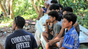
  • In remote areas of the Solomon Islands, police are often not present causing a challenge to maintain law and order.
  • Locally elected Community Officers are facilitating local justice and providing a vital link between the government and citizens in remote areas of the Solomon Islands.
  • Remote communities now know there is much needed help for conflict resolution, strengthening connections between communities and the state


Continue reading

Introducing the online guide to the World Development Indicators: A new way to discover data on development

The World Development Indicators (WDI) is the World Bank’s premier compilation of international statistics on global development. Drawing from officially recognized sources and including national, regional, and global estimates, the WDI provides access to almost 1,600 indicators for 217 economies, with some time series extending back more than 50 years. The database helps users—analysts, policymakers, academics, and all those curious about the state of the world—to find information related to all aspects of development, both current and historical.

Continue reading

eC2: Verification standard for land use climate funds – Definition of policies, processes and procedures

Deadline: 08-Nov-2018 at 11:59:59 PM (Eastern Time – Washington D.C.) land-administration-page

The World Banks Forest and Landscapes Team within the Climate Funds unit (GCCFM) sits in the Climate Change Cross Cutting Solutions Area (CCSA); it manages carbon funds and facilities, worth over $1.3 billion. There are two main carbon funds/facilities in the land sector that seek to pilot climate result based finance at large scale level: BioCF Initiative of Sustainable Forest Landscapes (ISFL) and the FCPF Carbon Fund.
It is expected that a total of 23 Emission Reduction Programs will be included in the portfolio of both funds.First monitoring is expected to occur from 2019 onwards but before the funds can make payments, reported results need to be verified. However, more is needed to define the terms of the modalities and procedures for verification under both funds. This definition is critical for ensuring the quality and environmental integrity of ERs generated. The WB is seeking a firm to support in the definition of a verification standard.

Continue reading

The Safe Food Imperative: Accelerating Progress in Low- and Middle-Income Countries

STORY HIGHLIGHTSfood_key

  • Unsafe food costs low- and middle-income economies US$ 110 billion in lost productivity and medical expenses each year.
  • Preventative measures—including greater investment, better regulatory frameworks and measures that promote behavior change—can help countries avoid food safety problems
  • An inclusive approach to food safety management that makes food safety a shared responsibility among government, farmers, food businesses and consumers will be most effective

Continue reading

eC2: Study on Understanding Participation of Young Farmer-Entrepreneurs in Agri-Businesses in Mindanao

Deadline: 05-Nov-2018 at 11:59:59 PM (Eastern Time – Washington D.C.) ls-a-day-in-the-life-of-a-vegetable-farmer-in-lesotho-780x439

The study aims to further understand what makes younger farmers thrive and engage successfully in agricultural businesses. The study is intended to provide in-depth information on design choices for the proposed Mindanao Inclusive Agriculture Development Project in terms of supporting an enabling environment for young farmers sustained participation in agriculture businesses.

Continue reading

What does Urban Resilience mean in the Eastern Caribbean context?

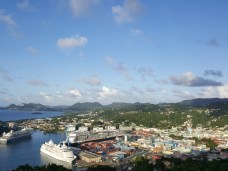
When you think of a city, what comes to your mind? Skyscrapers? Subways? Crowds of castries_saintluica.jpgpeople jostling each other as they head to work? And what comes to mind when you think of an Eastern Caribbean island? Sun, sand, beaches paradise? Yet, Eastern Caribbean countries also have cities of thousands of people. In 2017, 35% of the Eastern Caribbean* population was urban: 221,000 out of 628,000 people lived in cities.
Continue reading

eC2:GAFSP PrSW Kenya Impact Evaluation – Baseline

Deadline: 04-Nov-2018 at 11:59:59 PM (Eastern Time – Washington D.C.) agriculture-youth

Description: IFC is looking for an experienced evaluation firm to help conduct the baseline study of an impact evaluation of a project both IFC and the Private Sector Window of the Global Agriculture and Food Security Program (GAFSP) are investing in. The operations are in Kenya and is in the agribusiness sector.
The objective of the evaluation is to assess impact on beneficiary income, yields, and food security. The intended methodology is quasi experimental design.
IFC invites firms with strong background in impact evaluations to submit expression of interest. Experience with evaluations in the agribusiness sector in Africa required.

Continue reading

eC2: Smart Traffic Lights in Sao Paulo

Deadline: 06-Nov-2018 at 11:59:59 PM (Eastern Time – Washington D.C.)

São Paulo has approximately 6,500 signaled crossings a system which was first

Traffic in Beijing

established in the 70s. Since then, it underwent through two major attempts of technological renewal, without success. The public perception is of a system prone to failure, especially during rainy season. Last year, more than 35k incidents were reported. 70% of failures are due to wear and tear on equipment. The system is vulnerable to Brazilian inconstant power grid. Finally, most lights operate without central communication.

The WB is selecting a firm to provide technical advice to the City of Sao Paulo on their smart traffic lights program, with resources from the UK Prosperity Fund for Mobility. Considering the current infrastructure and traffic in São Paulo as well as the maturity of available solutions, the TA will compare technologies and develop an economic analysis to propose a strategy of gradual investments in the system to obtain increasing levels of service and sustainability.

Continue reading

eC2: Understanding urban flood risk in Jujuy, Argentina

Deadline: 31-Oct-2018 at 11:59:59 PM (Eastern Time – Washington D.C.)

The World Bank is seeking consultant services to analyze urban flood risk in the city ofpexels-photo-831890.jpeg San Salvador de Jujuy, Argentina, as part of the World Bank’s City Resilience Program. Specifically, the consultancy will focus in the Chijra River. The expected tasks include:
1. Diagnosis of current situation including compiling, preparing, complementing and / or updating existing information.
2. Develop a Digital Terrain Model for the whole basin using the existing information.
3. Analysis of hydrological aspects; mainly the review of the studies available within the basin and close to it, considering the historical values and the climatic tendencies indicated in the recent history.
4. Construction of a 1D hydrodynamic model for the area based on the MDT.
5. Evaluate the possibility of calibration of the models with background information.
6. Prepare the base cartography of the area based on the available information.
7. Define the design events for the exploitation of the hydrodynamic model.
8. Draw the flood lines for the different scenarios.
9. Analyze sediment transport at basin level.
10. Identify erosion / sedimentation zones.
11. Identify existing infrastructures that affect natural runoff.
12. Identify population and infrastructure exposed to risk.
13. Identify mitigation works for both floods and erosion / sedimentation phenomena.

The assignment and all deliverables will be in Spanish.

Continue reading